
Tagus River

It was in Tagus River that the biggest Portuguese adventure started. From this river departed the Portuguese ships (caravels and naus) of the great discoveries, finding new worlds.
From this side of the river itsriverbank goes through cities like Abrantes, Constância, Santarém and Vila Franca de Xira. In many of these villages and cities it left a tragic but also a valuable mark in the soils – the floods.
The last city that the river baths is Lisbon. There it has inspired many poets, musicians and film makers.
Tagus River Banks
CANEIRAS| SANTARÉM
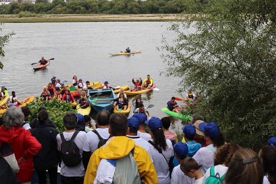
Near Santarém, on the river bank, there is a village that is the memory of a people nicknamed "river nomads". From the middle of the XIX century, families of fishermen from the beach area of Vieira de Leiria, moved to the riverside areas of the Tagus, fleeing the rigors of winter that did not allow them to seek their sustenance at sea. Seasonal displacement in which they made the boats their temporary home. They ended up settling on the banks of this river that provided them with fish all year round, especially shad, lamprey, and fataça, which are the basis of typical dishes of our region today.
They built small houses made first of reeds and then of wood, erected on stilts to protect themselves from the rises of the river. The houses, built on pillars to resist the floods of the river, were painted in bright colors, typical of the area where they came from, green, red, and blue, and usually according to the color of their own boats.
The Avieira culture is the only European fluvial stilt culture, and has original characteristics mainly in four features: in the boats, in the fishing arts, in the stilt buildings, and in the gastronomy.
Today, with the deterioration of the quality of the waters of the Tagus causing the reduction of fish, and their own desire to want a different life for their children, the population of the Avieira villages has begun to decline.
Still, the avian culture lives on. The fish have returned to the river, and children and grandchildren have also been returning to it, some to fish, others to use the houses as weekends resting places, and still others to develop more tourism-guided activities.
The avian culture (...) has survived by the hands of people who work, struggle, and resist, who change as and when necessary, and adapt, without, however, losing their identity.
Distrito: Santarém Concelho: Santarém Coordenadas GPS: 39º 11`21.19``N - 8º 41`04.07``O.

Barcos avieiros.
Imagem retirada de cm-santarem.pt

Casas, Caneiras.
Imagem retirada de lifecooler.com
The municipality of Santarém is located on the right bank of the Tagus, which limits it to the east and south of the Estremadura Limestone Massif of Porto de Mós (mountains of Aire and Candeeiros).
The Ribatejo corresponds to the Tagus sedimentary basin, establishing the transition between the coast and the interior.
Santarém had direct access to the sea through the navigability of the Tagus. Located on an elevation, its geographical location gives it views of the North and East of undeniable beauty. In this context stand out the Portas do Sol, a veranda overlooking the Tagus, landscaped in 1895, with a viewpoint made in the door towards the rising sun.
Throughout the county there are differences that correspond to distinct climatic, pedological, topographic and human intervention (land use) types. There are four well-individualized natural zones: Campo, Bairro, Heath and Serra.
More information: https://www.cm-santarem.pt/o-municipio/caraterizacao-santarem
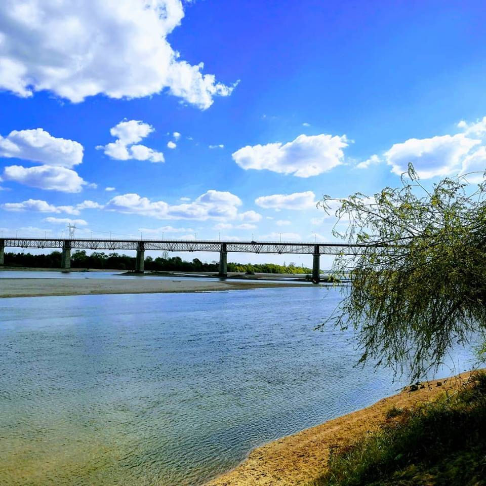
We adopted two bridges...
The municipalities of Almeirim and Santarém are currently connected by two bridges: D. Luís and Salgueiro Maia.
Bridge D. Luís
Important engineering work on the metal bridges of the industrial era in Portugal and a remarkable example of iron architecture.
In 1868, its construction was approved by Marquês Sá da Bandeira, as it was also considered strategic from a military point of view.
Construction began on April 6, 1876, was inaugurated on September 17, 1881 and named after D. Luís, in honor of King D. Luís, in whose reign it was built. great festivities in the two municipalities that unite, Santarém and Almeirim, signaling as great as the dream of the populations.
The D. Luís Bridge was considered at the time, "the largest in the Iberian Peninsula, the third in Europe and the sixth in the World", becoming one of the examples of iron architecture, the work of audacious engineers who believed in industrial iron as new. construction material. It was remodeled in 1956.
[In https://www.cm-santarem.pt/descobrir-santarem/o-que-visitar/item/1207-ponte-d-luis]
Bridge Salgueiro Maia
Many years later, a new bridge appeared, inaugurated on June 11, 2000, by the then Prime Minister Eng. António Guterres, now secretary-general of the United Nations, which was given the name Salgueiro Maia, emblematic figure of the 25th of April 1974, as one of the heroic Captains of April who made freedom possible in our country.
This new bridge is 570 meters long, comprising a deck and masts made of a monolithic piece supported by 8 pillars. The technique used to support the two main pillars provides a high degree of seismic isolation.
This bridge allowed a quality connection between the two municipalities.
[In https://www.cm-almeirim.pt/conhecer-almeirim/historia/item/186-as-duas-pontes]
